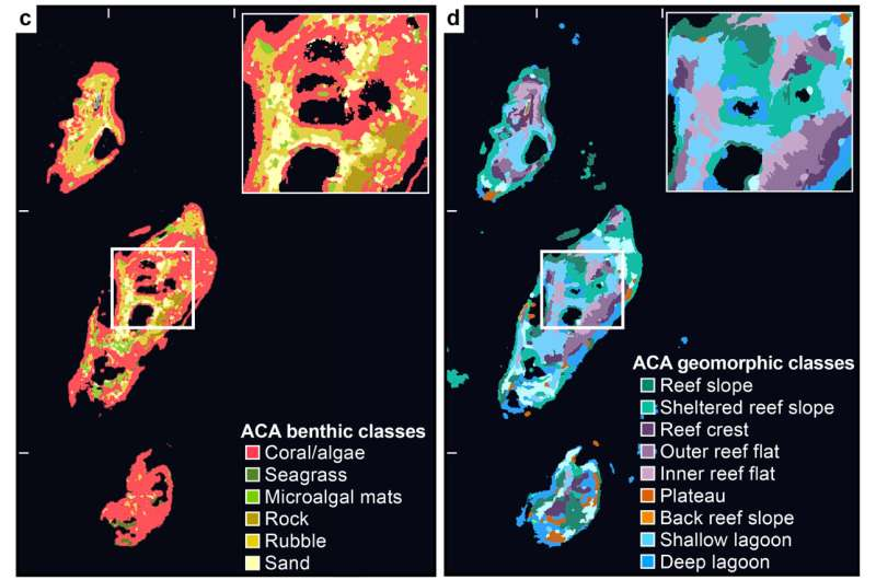
A 2024 study developed a method to predict reef biodiversity using remote sensing. Satellite imagery was used to develop maps that identify distinct marine habitats in the Fulaga Atoll of Fiji. This data was compared with measurements of the biodiversity of fish and coral collected by field researchers. The study found that areas of high habitat diversity had a positive correlation with areas of high biodiversity. The first of the four images below is a true-color image of the atoll, and the three following images are satellite-derived maps that assign a particular color to a distinct physical or biological region in the atoll. Areas of high habitat diversity have a relative abundance of colors per unit of area, and appear to have a more fine texture in which different colors are less distinguishable. Areas of low habitat diversity, on the other hand, have one or relatively few colors per unit of area, and are represented by single, smooth patches of color. A couple of regions, like ‘land’ and ‘sand’ are easy to identify in the true color image, but the maps make the habitats markedly easier to identify. This method could be used to infer measurements of biodiversity at other reef sites, at a much lower cost than deploying researchers in the field. 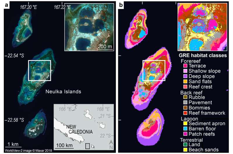
Monday, February 19, 2024
Inferring Reef Biodiversity with Satellite-Derived Maps
Subscribe to:
Post Comments (Atom)
https://phys.org/news/2024-02-satellites-global-reef-biodiversity.html
ReplyDelete