
Monday, October 30, 2017
Beetles are turning the Rocky Mountains into a Graveyard
Tuesday, October 24, 2017
Image of The Day, October 24, 2017

Monday, October 23, 2017
Lake Erie Algal Bloom, October 26, 2017

http://www.toledoblade.com/local/2017/10/23/Toledo-s-harmful-algal-bloom-season-comes-to-end.html
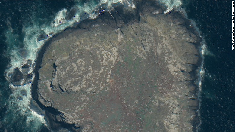
Thursday, October 19, 2017
Anarctic Larsen Ice Shelf: Massive Cleaving Event


Wednesday, October 18, 2017
Shrinking of the Aral Sea


These three images show the water cover extent of the Aral Sea in 1977, 1989, and 2006. Water level of the Aral Sea has been steadily dropping over the past several decades as water has been diverted from its tributaries for irrigation, to the point where the lake is now less than half its original size. This over-dependence on the Aral Sea’s water resources has also resulted in an increasingly exposed sea bed, which presents a serious problem both with the salinity level of the lake and the salinization of surrounding areas. Increased salt concentration in the water has spurred massive fish kills in the lake, while the salt left behind on the lake bed is swept up by wind and dust storms and deposited in the neighboring agricultural fields, resulting in reduced crop yield.
Tuesday, October 17, 2017
Point Rosee. Were the Norse there? October 17, 2017


This is
satellite imagery of Point Rosee in southwestern Newfoundland, a site
discovered by Sarah Parcak using remote sensing. She identified it as an area
of interest due to the discoloration and the rectilinear and circular, L-shaped
features that can be made out in the image suggesting man-made structures reminiscent
of Norse (Viking) culture. This was a research/documentary collaboration (Vikings
Unearthed) with BBC and several other television stations to use satellite
imagery to look for potential Norse sites south of the only known settlement in
North America (L'Anse aux Meadows). The darker areas of the image indicated the
possibility of turf structures under the surface because this would affect the growth
of vegetation (infrared sensing of vegetation). An exploratory dig was
conducted in 2015 and the results lead to a 2016 excavation season. What I
found interesting about this was how this research was portrayed in the media.
It began as a documentary project, so it already started out with bias. The
initial findings seemed to be sensationalized in a lot of media outlets making
Point Rosee appear as a newly discovered Norse Settlement but just waiting on
further confirmation with further excavation. But in reality, there were
initial findings that showed potential and a second dig was led in 2016
resulting with inconclusive evidence, and with some of the initial findings found
to more likely be a result of natural processes. The site requires further
analysis and excavation; there are a number of possibilities but there may
never be conclusive evidence to determine if Point Rosee was a settlement, a
work camp, a stopover, etc. But this does not make for exciting news. I also found there were several contradictory
statements about the site amongst different articles such as Point Rosee being
a bad location for the Vikings versus it being an ideal location. There seemed
to be a lot of misleading and bias present which I would expect when science is
purposed for popular culture consumption. It was difficult to get an overview
of what actually was happening with this site and what the results were. I had
to go through tens of news outlets and videos. However a huge takeaway was the
methodology of using satellite imagery to identify possible archeological
sites.
1).
- View From Space Hints at a New Viking Site in North America
- Point Rosee A Norse Settlement Site?
- Possible Viking Find Could Rewrite North American History
- Discovery Could Rewrite History of Vikings in New World
- An ancient site spotted from space could rewrite the history of Vikings in North America
- Vikings Unearthed | Netflix
- BBC uncovers new find that may be first Viking site discovered in North America in 55 years, in co-production with PBS science series NOVA
Thursday, October 12, 2017
Image of the day: October 12, 2017


This is a picture of potash pond in Moab, Utah. From the geometric shape of the pond, it is clear that it is man-made. The pond is used to produce potash, which has potassium that is useful as fertilizers. The blue color is due to dye to retain heat from sun and the different shades is due to different level of evaporation (the second picture). At the middle top of the first picture, there is a white and brown smudge which is where the activity of potash mining is done. The potash is mined by dissolving it in brine and then pumped to the potash pond to evaporate the brine and potash mixture to obtain pure potash.
Relevant website:
https://gizmodo.com/why-theres-an-electric-blue-lake-in-the-middle-of-the-u-1596118092
Monday, October 9, 2017
Albatrosses on South Georgia Island, Argentina
This image depicts endangered albatross birds on a remote island off the coast of Argentina. The faint white dots seen in the picture are the albatrosses. Remote sensing can be used to count endangered species in remote locations.The use of satellite imagery to count endangered species is important since it makes it easier to study population sizes in remote areas, such as these islands, which are usually difficult to get to and pose a risk of disturbing natural habitats if traveled to.
http://money.cnn.com/2017/05/04/technology/endangered-birds-space-satellite/index.html

Human Rights Applications of Remote Sensing: Maungdaw Myanmar
 |
| Late August, 2017 |
 |
| September 2, 2017 |
These high resolution, false-color images show the Burmese town of Maungdaw. The first image was taken some time in mid to late August, 2017 while the later image was taken on September 2, 2017. Using thermal satellite imagery, researchers at Human Rights Watch were able to detect active fires burning on August 28th. By comparing the the two-false color images below (taken before and after August 28th, respectively), the researchers were able to document the extent and effect of fires that destroyed buildings in tow neighborhoods of Maungdaw primarily inhabited by Rohingya Muslims, an ethic minority in Myanmar that has been persecuted by the Burmese government which refuses to recognize them as citizens. Human Rights Watch believes that these fires, which destroyed nearly 450 buildings, were set intentionally by the Burmese government to force them out of the country. The UN high commissioner for human rights has called this 'a text book example of ethnic cleansing' but the government of Myanmar denies any claims of systematic violence or wrongdoing.
I think these images represent an interesting application of false color imagery. The false color image emphasizes the dramatic change in vegetation. In the first image, houses are scattered throughout a rather forested part of the city. In the second image, most of this vegetation is gone (shown as pink, purple or brown) and the shapes of the interspersed houses are gone. In a situation where the government denies any wrongdoing, the missing vegetation and housing in two predominantly Muslim neighborhoods provides the most concrete circumstantial evidence to the contrary.
Wednesday, October 4, 2017
Image of the Day October 5, 2017

Tuesday, October 3, 2017
Image of the Day, October 4th, 2017
 |
| 2006 |
 |
| 2008 |
 |
| 2009 |
Monday, October 2, 2017
Image of the Day October 3, 2017

Photo: Lake Natron, Northern Tanzania
Date: March 6th, 2017
Satellite: Landsat 8 - Operational Land Imager (OLI)
True Color Image
Landsat 8- OLI true color image of a reddish-pink lake in Norther Tanzania. Red lakes are not common, which begs the question: why is this lake reddish-pink? Lake Natron's shallow waters are known for it's pink and red hues. The lake's uniquely warm temperatures (125 - 140 degrees Fahrenheit), salty, and alkaline chemistry is due to the volcanic activity in the area. Considered inhospitable for many organisms, haloarchaea, also known as salt-loving extremophile microorganisms, and cyanobacteria produce reddish-pink pigments that give the lake its rich pink and red color. These extremophile microorganisms provide an important food resource for the endangered Lesser Flamingo. During the dryer seasons, more than two million Lesser Flamingos use this area for protected nesting grounds, because there are no predators due to the formation of protected channels of the extreme lake chemistry. Lake Natron's high salt and bicarbonate chemistry received press, in recent years, for the calcified birds and bats found and photographed in 2013. Most scientists agreed that these animals died of natural causes and became "calcified" by being coated with sodium carbonate, due to their remains being in close proximity of the lake.
Image of the day
Nov 16, 2016

Jan 28, 2017

July 7, 2017

This set of satellite images show Cape Point at Cape Hatteras National Seashore just to the East of North Carolina. What is depicted in these images is the creation of a new island due to the movements and changes in the currents and wave energy of the water surrounding and hitting the land. As the waves move around the tip of this island they lose energy and deposit sediment that they were carrying. This causes a build up of sand and eventually the creation of an island. The scale of the island can be judged off of the size of the roads as well as what appears to be a city or town of some sort on the land to the North. What is important about this picture is the time frame in which it happened. This type of land creation normally takes an extremely long time. With the satellite imaging, however, we can see and begin to speculate as to why this occurred in such a rapid manner. By tracking the events around this area between the dates of the picture we can better understand what happened and how influential different types of weather and natural phenomena are when it comes to the creation of the offshore sand islands, or just how the effect the land in general.
Subscribe to:
Posts (Atom)