
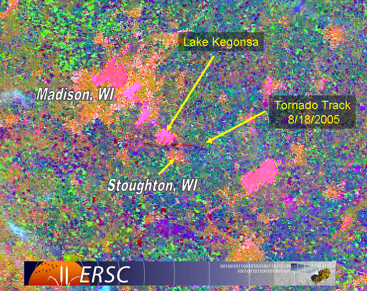
This image is an aerial photograph of Stoughton, WI in the aftermath of the tornado which went through the area on August 18th, 2005. This image contains a combination of Landsat MODIS and Aster and represents the change in landscape where the path of the tornado is shown in a red color. The imagery is important as it can be used by emergency agencies in determining the location and extent (house, town, county) of the damage where the help should be focused. Additionally, this imagery could be used to help determine what kind of assistance is required to the areas affected.
No comments:
Post a Comment