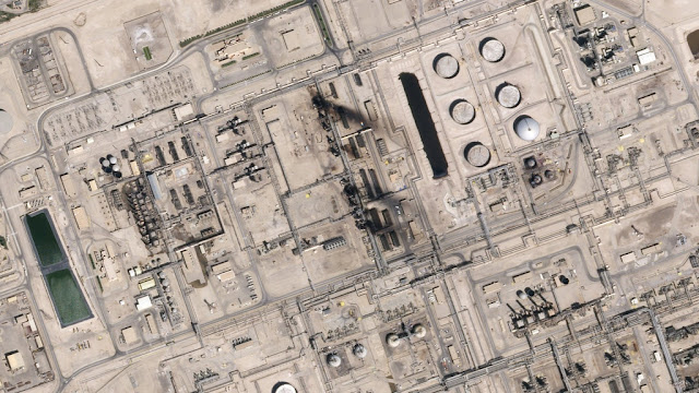
On September 14, 2019 two major Saudi oil facilities were attacked by drone strikes, causing them to lose nearly 6 million barrels of oil. These images found in the New York Times were taken following the strikes and were used to determine the extent of the damage as well as to try and determine who attacked the plants and from where.
Remote sensing in the media has become ubiquitous, with satellite imagery appearing in everything from the news to sitcoms to blockbuster movies, and even commercials. Given the varying levels of quality and interpretability, there is much to think about and discuss!
Tuesday, October 1, 2019
September 14 Saudi Oil Attack
On September 14, 2019 two major Saudi oil facilities were attacked by drone strikes, causing them to lose nearly 6 million barrels of oil. These images found in the New York Times were taken following the strikes and were used to determine the extent of the damage as well as to try and determine who attacked the plants and from where.
Subscribe to:
Post Comments (Atom)


No comments:
Post a Comment